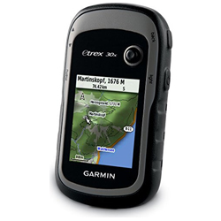
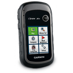
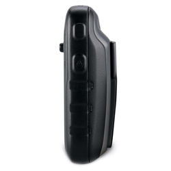
eTrex 30x is one of the most popular and reliable handheld GPS units. Durable and waterproof, it has an enhanced 65k colour sunlight-readable display with improved resolution (240 x 320p) for excellent readability. Featuring a microSD cart slot and 3.4 GB internal memory, eTrex 30 lets you load a range of Ordnance Survey maps such as Garmin GB Discoverer which will help you navigate whatever the terrain. In addition, the eTrex 30x also allows wireless data transfer (to compatible devices) and possesses a 3-axis compass and barometric altimeter.
With its high-sensitivity WAAS/EGNOS-enabled GPS receiver and HotFix satellite prediction, eTrex 30x locates your position quickly and precisely and maintains its GPS location even in heavy cover and deep canyons. The new eTrex series is also the first ever consumer grade receivers that can track both GPS and GLONASS satellites simultaneously making the time it takes for the receiver to ‘lock on’ to a position approximately 20 percent faster than when using GPS alone.
Specifications:
Physical & Performance:
- Unit dimensions (W x H x D): 5.4 x 10.3 x 3.3 cm
- Display size (W x H): 3.5 x 4.4 cm
- Display resolution (W x H): 240 x 320 pixels
- Display type: transflective, 65-K colour
- Weight: 141.7 g with batteries
- Battery: 2 AA batteries (not included); NiMH or Lithium recommended
- Battery life: 25 hours
- Waterproof: yes (IPX7)
- Floats: no
- High-sensitivity receiver: yes
- Interface: USB
Maps & Memory
- Preloaded maps: TopoActive Western Europe
- Ability to add maps: yes
- Built-in memory: 3.4 GB (expandible using a microSD card max. 32GB)
- Accepts data cards: microSD card (not included)
- Waypoints/favorites/locations: 2000
- Routes: 200
- Track log: 10,000 points, 200 saved tracks
Features:
- Automatic routing (turn by turn routing on roads): yes (with optional mapping for detailed roads)
- Electronic compass: yes (tilt-compensated, 3-axis)
- Touchscreen: no
- Barometric altimeter: yes
- Camera: no
- Geocaching-friendly: yes (paperless)
- Custom maps compatible: yes
- Photo navigation (navigate to geotagged photos): yes
- Outdoor GPS games: no
- Hunt/fish calendar: yes
- Sun and moon information: yes
- Tide tables: yes
- Area calculation: yes
- Custom POIs (ability to add additional points of interest): yes
- Unit-to-unit transfer (shares data wirelessly with similar units): yes
- Picture viewer: no
- Garmin Connect compatible (online community where you analyse, categorise and share data): yes
What’s in the Box:
– eTrex 30
– USB cable
– Manual